Category:Lindesche molen, Linde
Jump to navigation
Jump to search
| Object location | | View all coordinates using: OpenStreetMap |
|---|
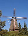
windmill in Vorden, Netherlands  | |||||
| Upload media | |||||
| Instance of | |||||
|---|---|---|---|---|---|
| Location | Vorden, Gelderland, Netherlands | ||||
| Street address |
| ||||
| Located on street |
| ||||
| Has use | |||||
| Heritage designation |
| ||||
| Source of energy | |||||
 | |||||
|
This is a category about rijksmonument number 38124
|
| Address |
|
Media in category "Lindesche molen, Linde"
The following 6 files are in this category, out of 6 total.
-
 Detail molenrijm - Linde - 20140391 - RCE.jpg 1,195 × 1,200; 250 KB
-
 Exterieur OVERZICHT - Linde - 20301066 - RCE.jpg 1,200 × 1,190; 278 KB
-
 Exterieur OVERZICHT - Linde - 20301067 - RCE.jpg 1,200 × 1,200; 241 KB
-
 Linde plaats.jpg 486 × 648; 22 KB
-
 Linde2.jpg 1,631 × 1,087; 189 KB
-
 Lindesche molen.jpg 429 × 549; 31 KB


